
Five East Java Peaks Under Fire as Authorities Halt All Mountain Climbing
Kabarsaji.com – BNPB – East Java’s volcanic and highland landscape, long celebrated for its dramatic crater lakes, dense cloud forests, and challenging trekking routes, is now gripped by a coordinated wave of land and forest fires. The National Disaster Management Agency (BNPB) confirmed on Friday that active hotspots have been detected across five separate mountainous zones in the province, forcing a blanket suspension of climbing and hiking operations to protect visitors and local communities.
The announcement came from Jakarta, where Berton SP Panjaitan, acting head of the agency’s Disaster Data, Information, and Communication Center, briefed reporters on the latest satellite and ground-monitoring data. His remarks underscored the scale of the emergency: no single peak is isolated from the others, and the combined threat spans a corridor stretching from the eastern reaches of Banyuwangi to the central highlands of Pasuruan and Probolinggo.
The Five Affected Zones
Monitoring conducted through the afternoon of Friday identified active burning on the following ranges:
Mount Semeru, straddling Lumajang and Malang regencies; Mount Wilis, spanning Nganjuk and Kediri; Mount Ungup-Ungup, linking Banyuwangi and Bondowoso; Mount Arjuno Welirang in Pasuruan; and Bukit Sariwani in Probolinggo. Together these sites represent some of the most ecologically sensitive and tourist-dependent terrain in the province, making the simultaneous outbreak particularly alarming for both conservation managers and the regional tourism economy.
Semeru Bears the Heaviest Toll
Among the five locations, Mount Semeru has sustained the most extensive damage. Since the initial outbreak on August 26, 2026, flames have consumed approximately 1,888.91 hectares of vegetation and bare ground in the Ranukembang area, Ranupane Village, the corridor along the Post 1 hiking trail, and the slopes west of Ranu Kumbolo — one of the most popular overnight camping destinations on the mountain’s northern flank.
Aerial suppression operations, which had been carried out using the East Java Provincial Government’s PK-DAP helicopter, were temporarily grounded after crews encountered electrical system malfunctions and repeated failures of the water-bucket delivery mechanism. With aerial support unavailable, ground teams have been forced to rely on manual suppression techniques and the construction of firebreaks across terrain that is often too steep for mechanized equipment.
Ijen Crater Reserve Closed as Ungup-Ungup Fire Spreads
On the eastern edge of the province, a blaze on Mount Ungup-Ungup in Banyuwangi crossed the administrative boundary into Bondowoso, scorching roughly 20 hectares of forest. The spread prompted authorities to shut down the Ijen Crater Nature Reserve effective Friday, September 4. The closure follows the earlier decision by Bromo Tengger Semeru National Park (TNBTS) management to close the Mount Semeru hiking trail on August 26, 2026, meaning two of East Java’s most iconic natural attractions are now inaccessible to visitors simultaneously.
Wilis, Arjuno Welirang, and Sariwani: Containment Complicated by Topography
On Mount Wilis, fires have already blacked out an estimated 16 hectares of vegetation across the Nganjuk and Kediri sectors. At Mount Arjuno Welirang and Bukit Sariwani in Probolinggo, crews report that persistent smoke plumes rising from the upper slopes remain difficult to suppress because of the sheer gradient of the terrain. Wind patterns in these highland zones can carry embers hundreds of meters in seconds, complicating any attempt to establish a stable containment line.
Multi-Agency Ground Response Underway
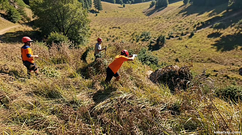
Berton confirmed that a joint operational team is deployed at every affected site. The coalition includes personnel from the Regional Disaster Management Agency (BPBD), TNBTS rangers, Grand Forest Park (Tahura) officers, state forestry company Perhutani, Indonesian National Armed Forces (TNI) units, Indonesian National Police (Polri) detachments, Manggala Agni elite firefighters, and local volunteer groups. Their mandate is to reach every accessible hotspot and prevent further spread until conditions allow aerial assets to resume.
“A joint team from the Regional Disaster Management Agency (BPBD), Bromo Tengger Semeru National Park (TNBTS), Grand Forest Park (Tahura), state forestry firm Perhutani, the Indonesian National Armed Forces (TNI), the Indonesian National Police (Polri), Manggala Agni, and volunteers continues to conduct ground operations against accessible hotspots,” Berton said.
Public Advisory and Seasonal Context
East Java’s dry season, which typically runs from June through September, brings low humidity, strong afternoon winds, and accumulated dead leaf litter that turns routine agricultural burning into uncontrolled wildfires within minutes. The BNPB has urged residents, hikers, and tourists to observe all posted closures at mountain tourism destinations and to comply strictly with provincial prohibitions on open land burning. Even small, seemingly contained fires on adjacent farmland can migrate into protected forest zones and reignite larger conflagrations.
“The public is also requested to immediately report any fires or smoke plumes in forest zones to local authorities so they can be addressed promptly,” Berton said.
The simultaneous closure of Semeru’s trail and the Ijen Crater Reserve represents a significant disruption for the province’s tourism calendar, which normally draws tens of thousands of domestic and international trekkers to these sites each dry-season window. Local guides, homestay operators, and transport providers in Lumajang, Banyuwangi, and Bondowoso face immediate revenue losses, while conservation managers warn that repeated fire cycles degrade the cloud-forest canopy that shelters endemic bird species and regulates watershed flow for downstream rice paddies. Until the last hotspot is extinguished and aerial assets are restored, authorities expect the climbing ban to remain in force across all five zones.
Related Reading
Frequently Asked Questions
What is BNPB?
BNPB is the main topic of this guide. The article explains the context, practical details, and next steps readers should understand.
Why does BNPB matter?
BNPB matters because readers are looking for a useful answer, not just a short summary. Good content should match search intent and help them decide what to do next.