
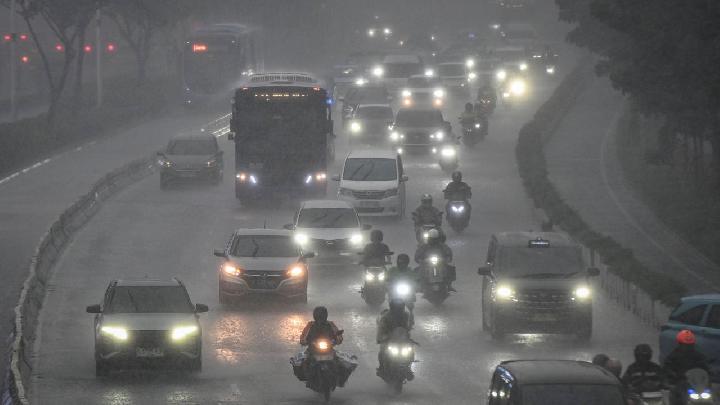
Rain and Clouds Expected Across Indonesia as Convergence Zones Strengthen
Kabarsaji.com – Much of Indonesia is expected to see cloudy conditions and periods of rain on Saturday, with weather risks ranging from light showers in many cities to heavier rainfall, thunderstorms, and gusty winds in selected areas.
The Meteorology, Climatology, and Geophysics Agency (BMKG) has highlighted atmospheric conditions that could support the growth of rain-bearing clouds over several parts of the country. Residents planning outdoor activities, intercity travel, or sea journeys may need to monitor local weather developments, particularly where rain could become more intense.
Padang Faces the Strongest Rain Outlook
Padang is forecast to receive moderate to heavy rain, with the possibility of lightning. The outlook places the West Sumatran city among the locations facing the most unsettled conditions during the day.
Thunderstorms can bring rapid changes in visibility, heavier downpours over short periods, and stronger winds. People in areas affected by lightning are generally advised to remain alert to changing conditions and to take extra care when travelling or spending time outdoors.
Light rain is also anticipated in Banda Aceh, Medan, Tanjung Pinang, Jambi, Bengkulu, Bandung, Semarang, Tanjung Selor, Mamuju, Palu, Nabire, and Jayawijaya. While these showers are expected to be less severe than the weather projected for Padang, rainfall may still affect daily commutes and outdoor plans.
Cloudy Skies Forecast for Numerous Major Cities
Cloud cover is expected to dominate the weather in a broad group of major cities. The cities forecast to experience cloudy conditions include Pekanbaru, Jakarta, Serang, Yogyakarta, Surabaya, Denpasar, Mataram, Kupang, Makassar, Kendari, Gorontalo, Manado, Ambon, Ternate, Sorong, Manokwari, and Jayapura.
Cloudy weather does not necessarily mean dry conditions for an entire day. In tropical regions, cloud formations can develop and shift quickly, so people in these cities may still wish to prepare for occasional changes in the weather, especially when travelling between districts or heading out for extended periods.
The widespread cloudiness and rain potential are linked to convergence zones in the region. These are areas where winds meet, encouraging air to rise and allowing clouds to build. Such patterns can increase the likelihood of rain in the zones influenced by the converging airflow.
One convergence area has formed from the Gulf of Thailand toward the South China Sea. Another extends from the northern coast of Papua New Guinea toward the Pacific Ocean north of Indonesia. The resulting atmospheric setup may help rain clouds develop across affected parts of the archipelago.
High Waves Possible Near North Sumatra
Weather concerns are not limited to land. On Friday, September 11, BMKG warned that several waters near North Sumatra could experience waves reaching as high as four metres between September 11 and 14, 2026.
The affected waters include the sea west of the Nias Islands, west of the Batu Islands, and east of the Nias Islands. Strong winds are driving the elevated wave risk, creating potentially hazardous conditions for maritime activity in those areas.
“Waves reaching four meters in height could occur in the waters west of the Nias Islands, west of the Batu Islands, and east of the Nias Islands,” said Dasmian Sulviani, a forecaster at the BMKG Class II Maritime Meteorology Station in Belawan, Medan.
Wave conditions of that height can be particularly significant for smaller vessels and coastal operations. Mariners, fishing communities, and passengers using sea transport routes near the affected waters may need to pay close attention to official marine forecasts and operational notices during the warning period.
A shift in wind patterns over northern Sumatra has contributed to the marine outlook. Warm sea-surface temperatures in the Indian Ocean west of Sumatra may also encourage convective cloud formation over the Sumbagut region, adding to the potential for unstable weather.
What the Forecast Means for Daily Activities
Indonesia’s weather can vary substantially between islands, provinces, and even neighbouring urban areas. A city forecast for clouds may experience only overcast skies, while another location under the same broader weather pattern may receive a brief but intense shower. This makes local updates especially important for people whose work, travel, or plans depend on weather conditions.
Motorists may encounter reduced visibility and slippery roads during rain. Pedestrians and commuters can benefit from carrying rain protection and allowing extra time for travel. In areas where lightning and stronger winds are possible, outdoor activities may require more caution.
For coastal communities and those using marine routes around North Sumatra, the four-metre wave forecast deserves particular attention through September 14. Sea conditions can change rapidly, and local authorities or transport operators may issue further guidance as conditions evolve.
The outlook for Saturday reflects a combination of cloud-producing atmospheric convergence, regional wind changes, and warm ocean conditions west of Sumatra. With light rain expected in many cities, heavier weather possible in Padang, and high waves forecast in parts of North Sumatran waters, residents and travellers are encouraged to stay prepared for shifting conditions throughout the day.
Related Reading
Frequently Asked Questions
What is Today s Weather?
Today s Weather is the main topic of this guide. The article explains the context, practical details, and next steps readers should understand.
Why does Today s Weather matter?
Today s Weather matters because readers are looking for a useful answer, not just a short summary. Good content should match search intent and help them decide what to do next.